Old Nautical Charts of Florida
1:400,000
Scale Charts 13-14-15, 17-18
Florida Coastline
Florida Home
Florida Nautical
Home
Click here to view and purchase these maps and more through our
store at shop.old-maps.com
|
| 13 - St. Marys to Entrance to Cape
Canaveral |
 |
| 14 - Cape Canaveral to Fowey Rocks |
| 15 - Straits of Florida |
| 16 - (Not Currently Available) |
| 17 - Tampa Bay to Cape San Blas |
| 18 - Cape San Blas to Mississippi Passes |
| |
| |
| |
| |
| |
| |
|
|
Click on a map below to view a larger
version |

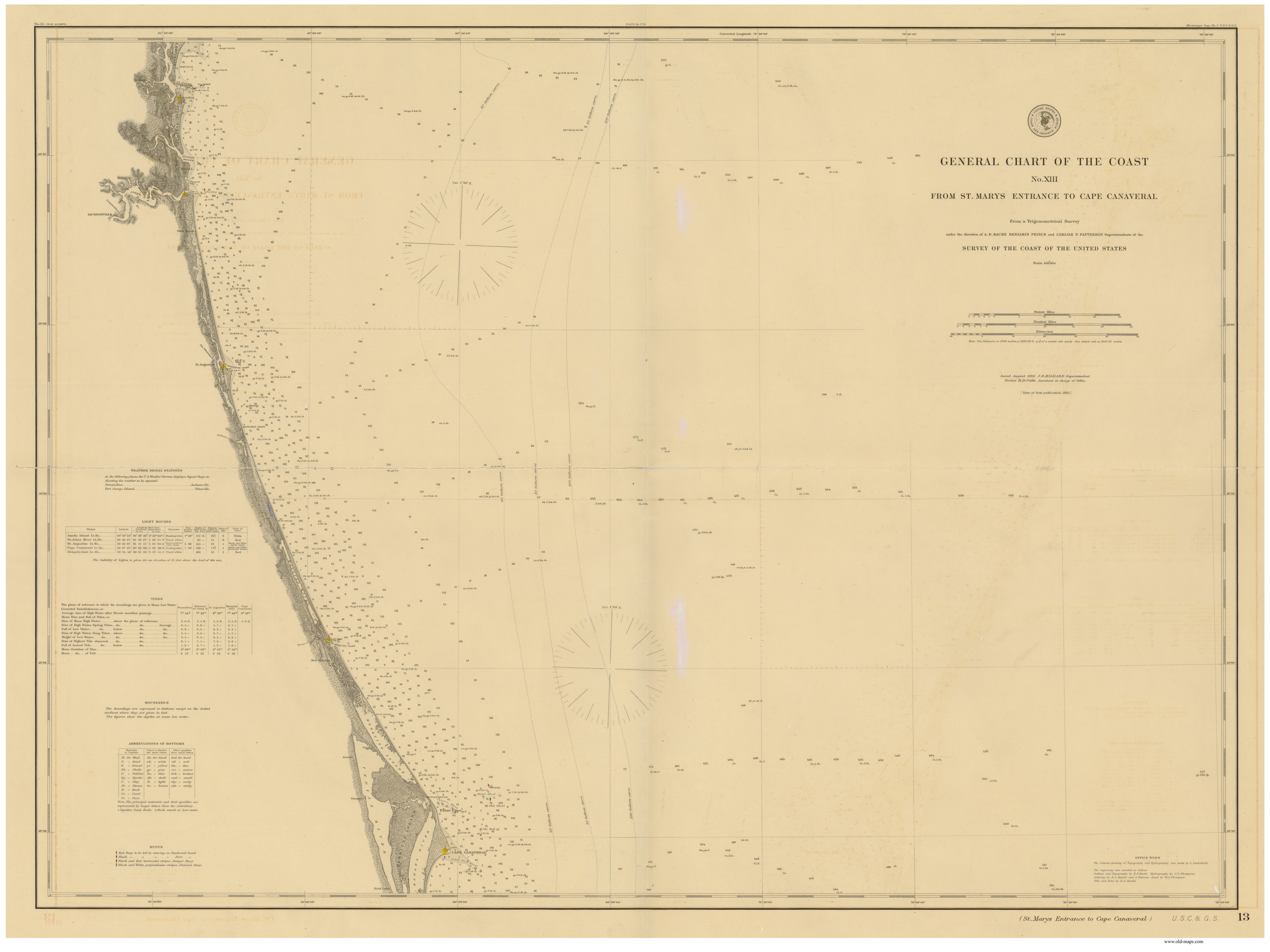
Chart 13 - St. Marys to Entrance to Cape Canaveral 1882
Original Size: 34" x 45" |

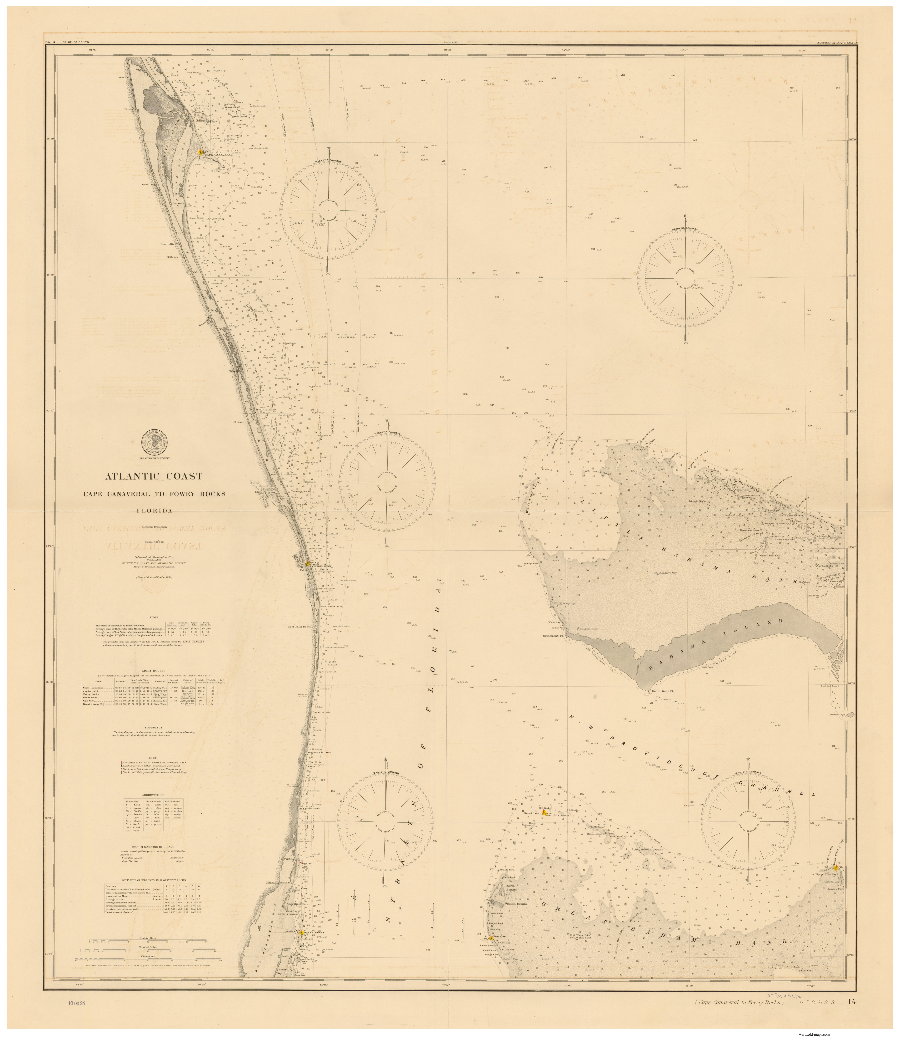
Chart 14 -
Cape Canaveral to Fowey Rocks 1900
Original Size: 37" x
45" |
|
|
|

Chart 15 - Straits of Florida 1895
Original
Size: 35" x 45" |

Chart 17 - Tampa Bay to Cape San Blas 1888
Original Size: 36" x 45" |
|
|
|

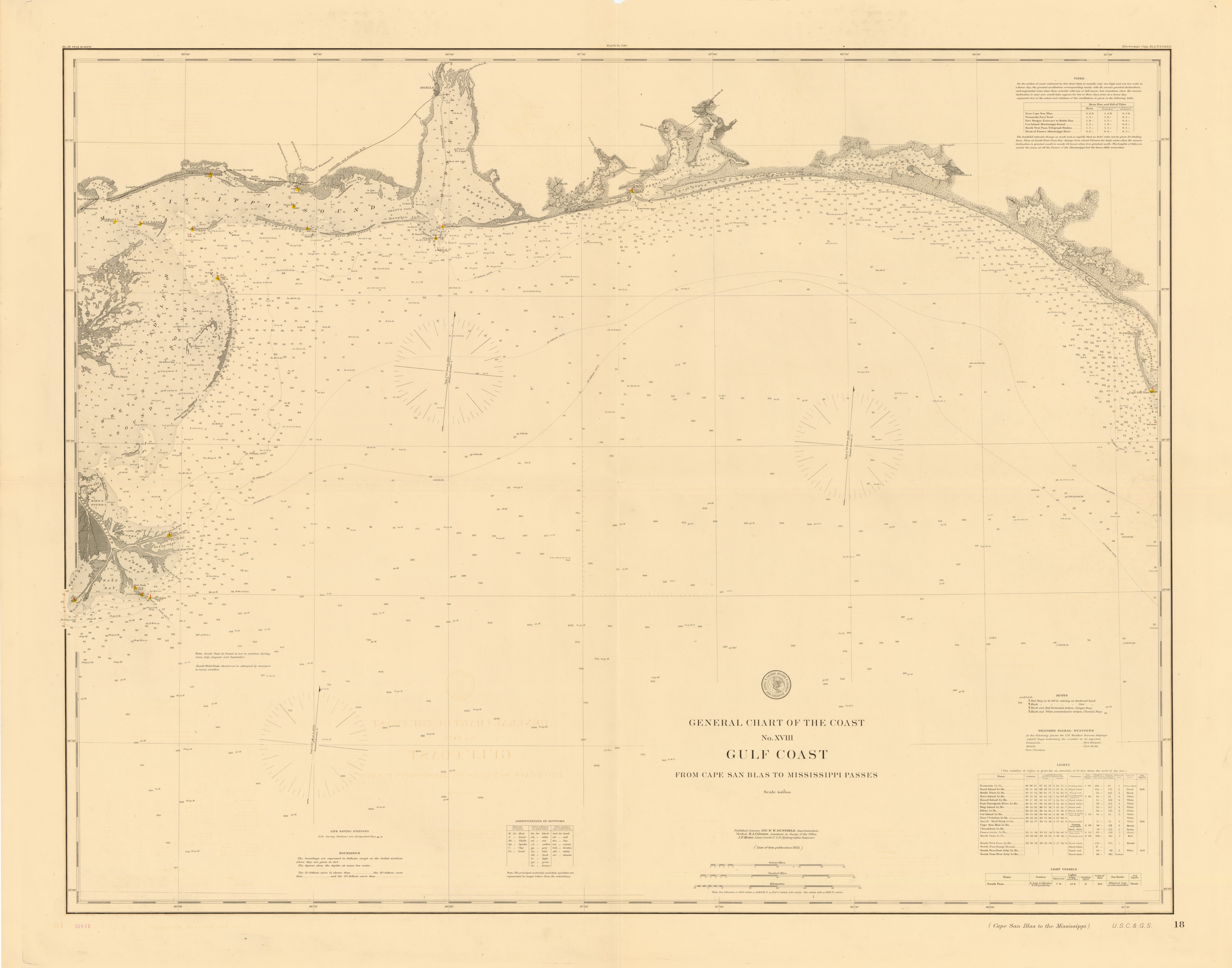
Chart 18 - Cape San Blas to Mississippi Passes 1895
Original Size: 35" x 45"
|
|
|