Historical Nautical Charts
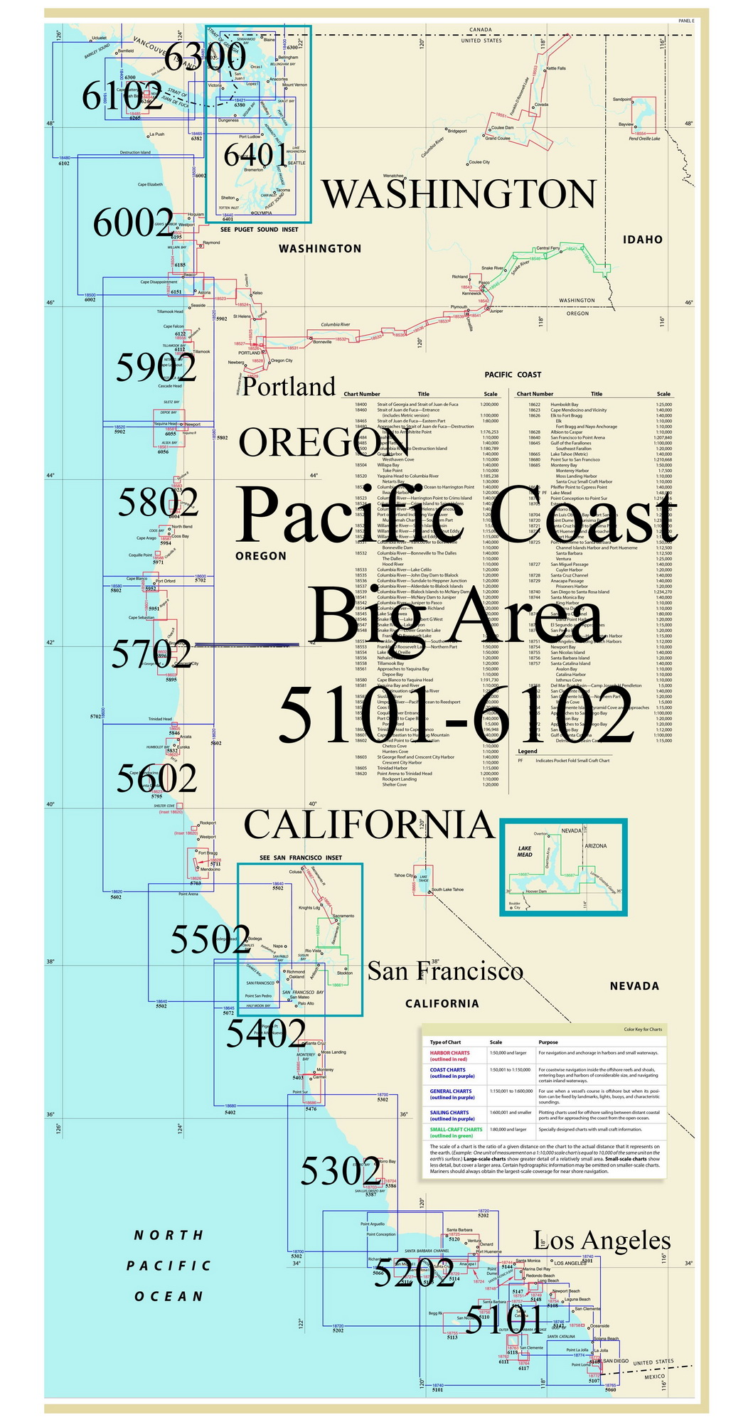
Pacific Coast Nautical Charts
Old Maps Home
Nautical Charts Home
Atlantic Coast Nauticals
We have collected Nautical Charts of varying scales detailing harbors and waterways from southern California up to Alaska.
These charts are arranged in several series, follow the links below to view the first few series we have prepared on our new website!
1:1,200,000 Sailing Charts
Nautical Charts of Alaska
We have Pacific Coast Harbor
Charts covering the following regions:
Southern California
Northern California
Oregon
Washington
Pacific Coast 1:200,000 Scale, 1890s
Pacific Coast Big Area, post-1917
Revised: 11/30/15
Copyright © 2005 [Old Maps]. All rights reserved.