|
Old Connecticut State Maps
Attractive maps for wall
display- Reprints
Home
County Maps
Birds Eye Views
Nautical Charts |
|
These maps were chosen for their charm as well as their historical
value. Click on a map for an enlarged view.
Each map is
available in for purchase at multiple sizes through our new store at
shop.old-maps.com!
Click here to browse the collection!
|
|

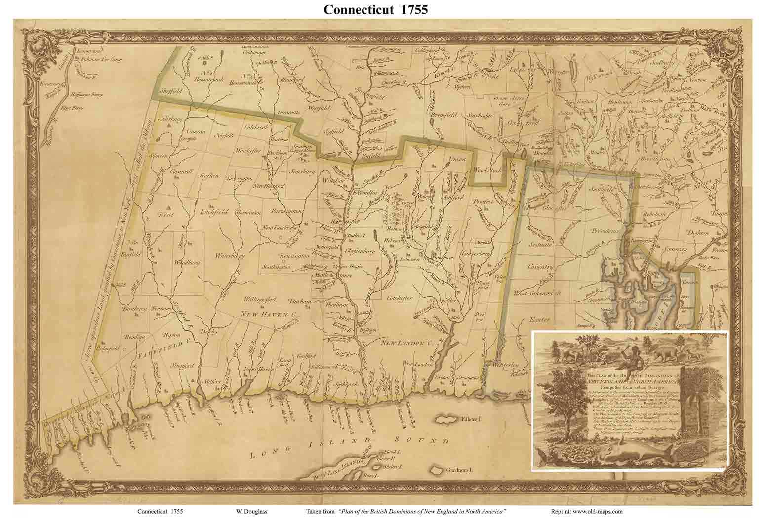
1755 Douglass
Excerpt from the old New England Map |

1766 Park
Primitive colonial map. Early county
boundaries (different than today)
|

1768 Jeffreys
Excerpt from the old New England Map |
|

1780 Covens & Mortier
(22"x24" original) |

1796 Sotzmann
German map...very attractive
|

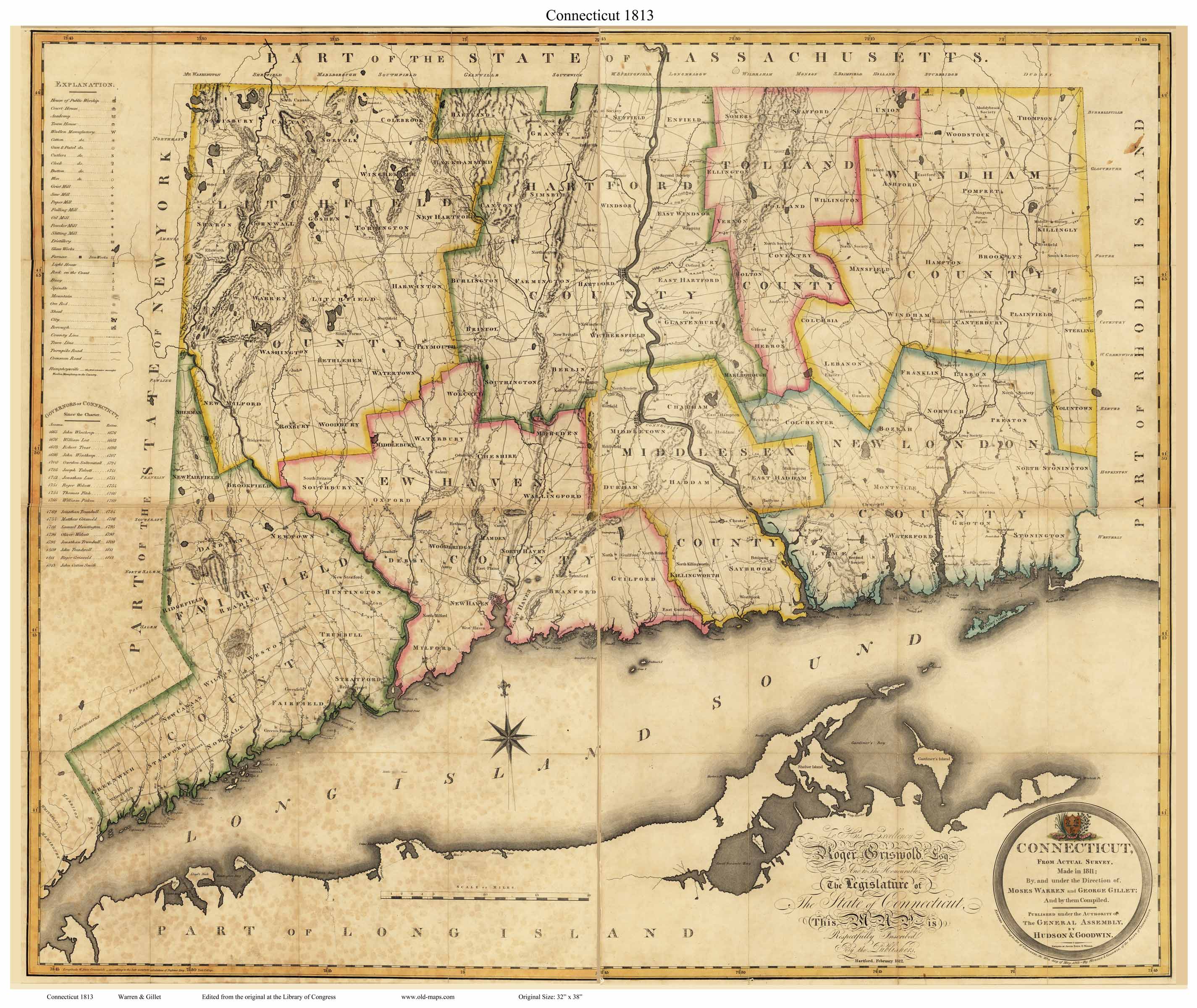
1813 Warren & Gillet
|
|

1822 Carey Atlas Map |

1827 Amos Doolittle
Town lines, major roads, attractive cartouche
|

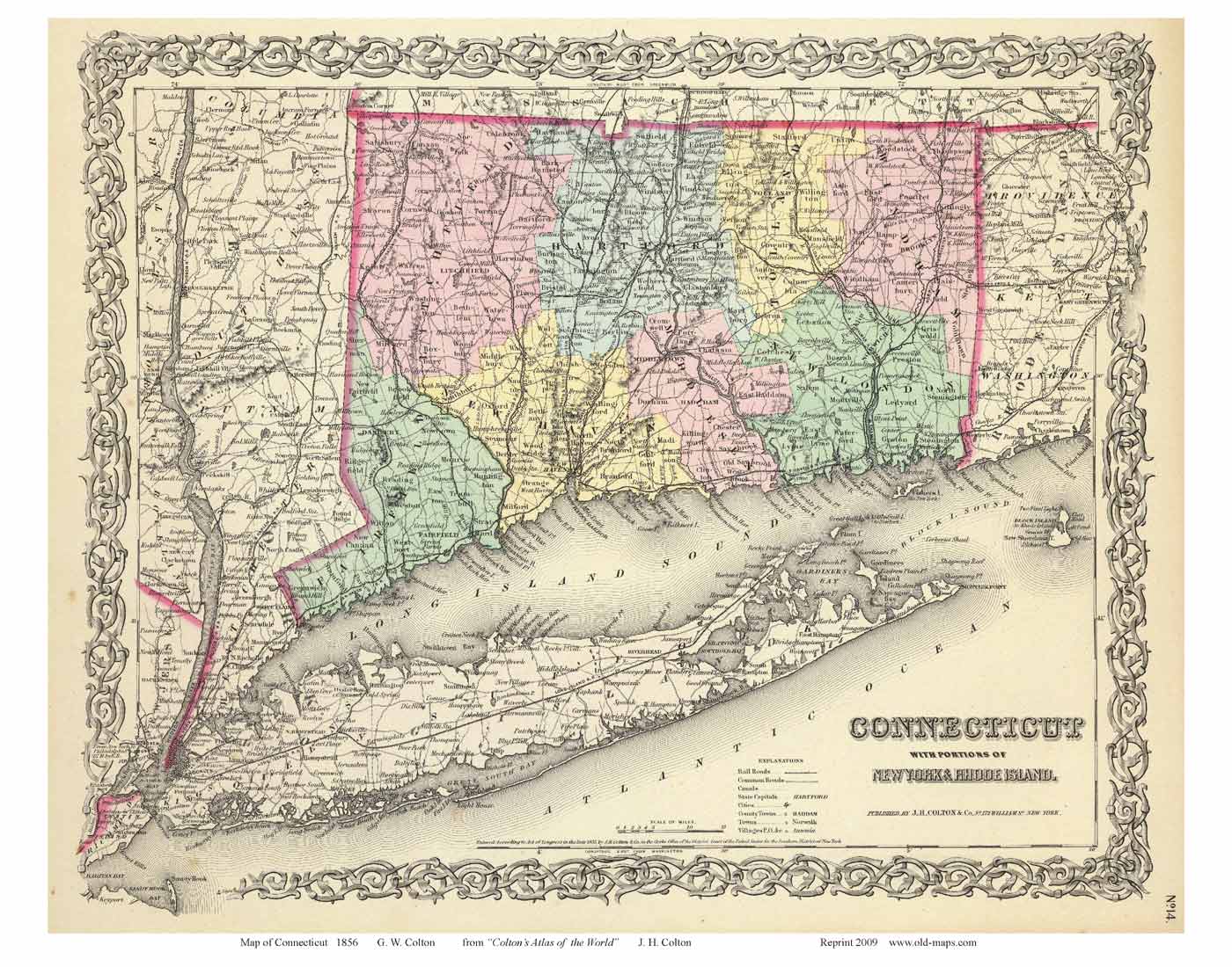
1856 Colton
Railroads, roads, Town Lines. Counties
tinted.
Includes Rhode Island & Long Island
|
 Revised:
11/22/21
Revised:
11/22/21