|
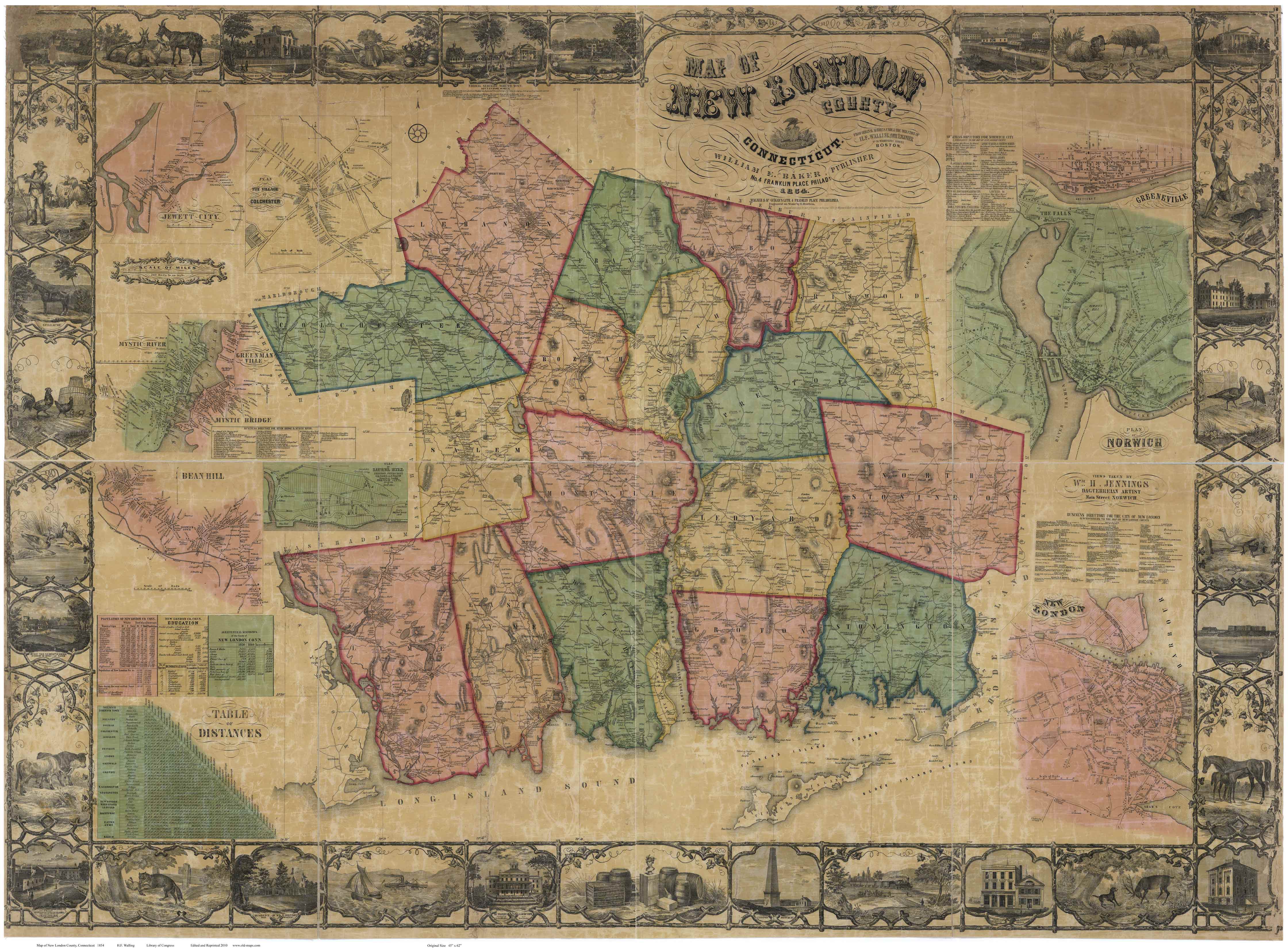
Wall Map of New London County
Connecticut
1854 WALL MAP REPRINT
Home
Town Maps
CDROM |
|
Click here
to purchase this map through our store at shop.old-maps.com |

Click the above image to see a larger view.
(Original from Library of
Congress, Geography and Map Division)
|
Featuring these New London County Towns: |
|
BOZRAH |
LEBANON |
NORTH STONINGTON |
|
COLCHESTER |
LEDYARD |
NORWICH |
|
EAST LYME |
LISBON |
PRESTON |
|
FRANKLIN |
LYME |
SALEM |
|
GRISWOLD |
MONTVILLE |
STONINGTON |
|
GROTON |
NEW LONDON |
WATERFORD |
|

|
The 1854
"Map of New London County, Connecticut" is
available as a reproduction print in multiple sizes.
Original size: 47" x 63"
Contents of
the Wall Map |
 Revised:
02/22/17
Revised:
02/22/17