Old-Maps

Vermont
Massachusetts
New Hampshire
Maine
Connecticut
New York
Rhode Island
New England
About Us
News Coverage
Contact Us
Order Form
FAQ

Masschusetts:
State Maps
Counties:
Barnstable, Dukes & Nantucket
Berkshire
Bristol
Essex
Franklin

Hampden
Hampshire
Middlesex
Norfolk
Suffolk
Plymouth
Worcester


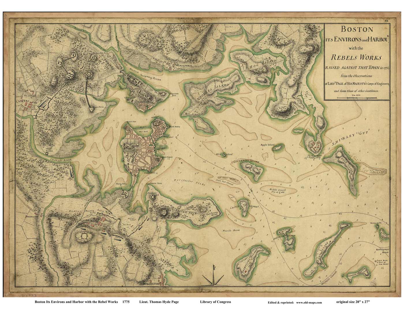
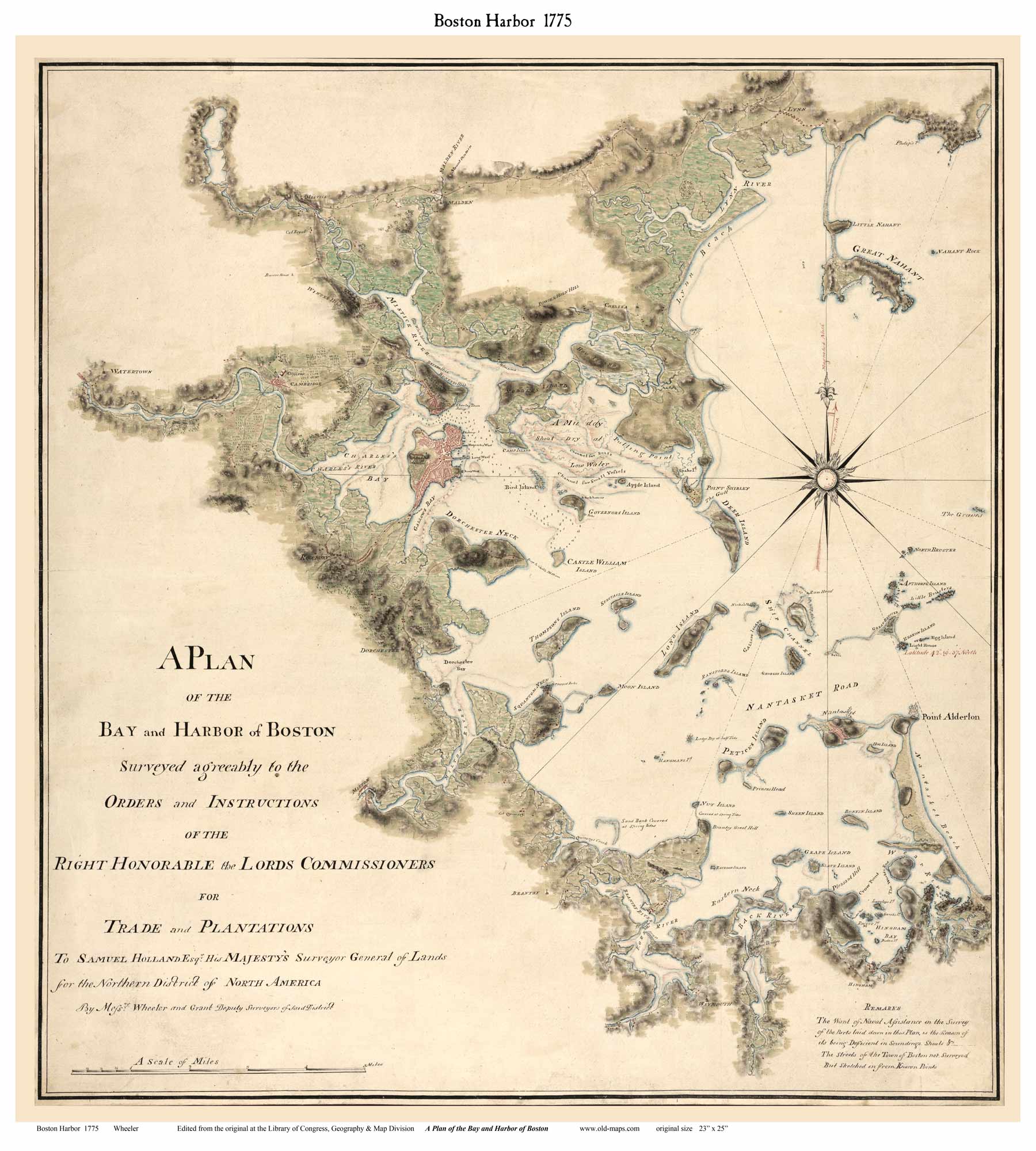
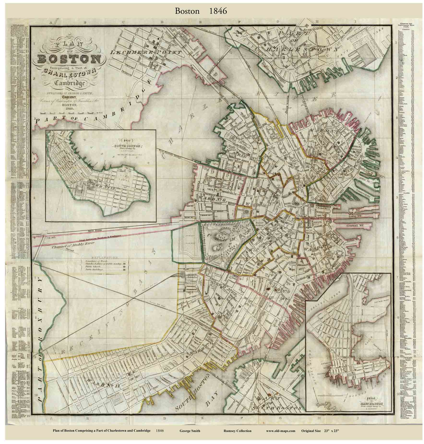
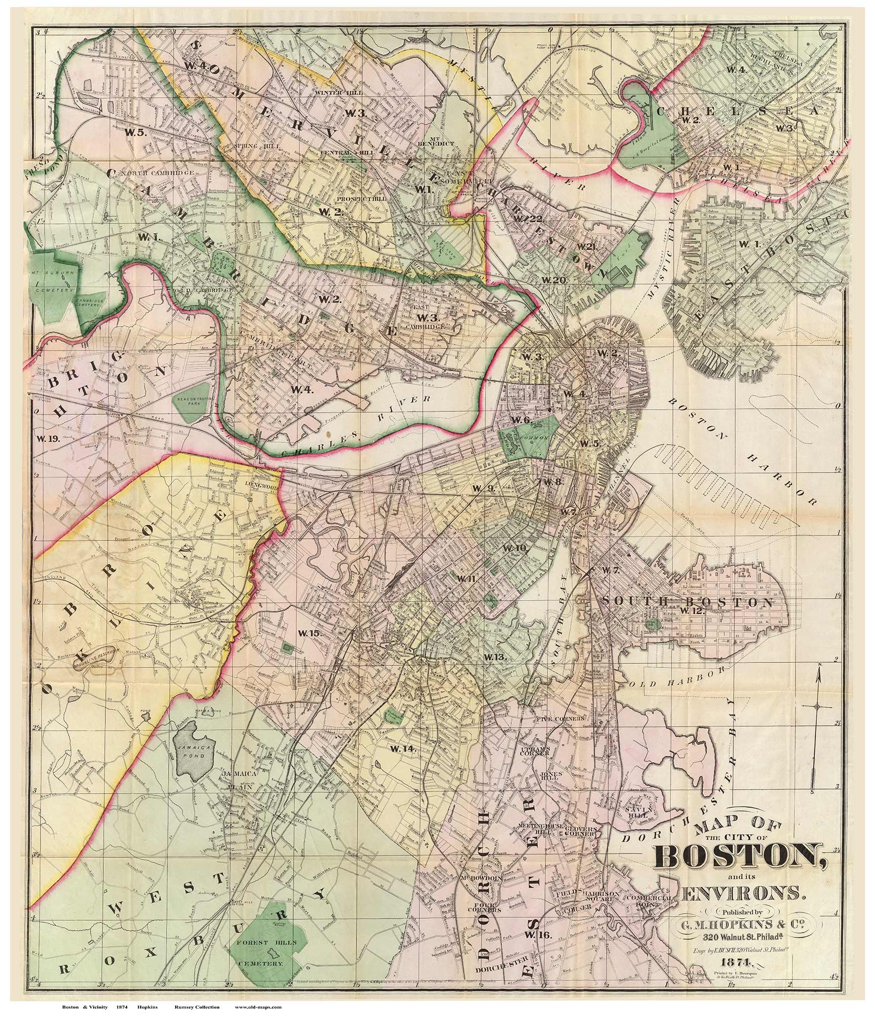
Old  Maps  of  Boston
Attractive maps for wall display - Reprints

 Map size is the paper size. Each map has a margin.* The listing in bold type is the minimum size recommended for legibility.  The original map's image size is listed in fine print.
Click on a thumbnail to see a low-res view of the map (images are degraded for the web).
* Maps can be printed in any size - send us an email for special sizes.
See also  Boston Bird's Eye Views       &      1852 County Wall map on CD

Click here to view and purchase these Boston Maps through our store at shop-old.maps.com

1728  Burgiss

1769  Price   Great Town
A New Plan of Ye Great Town of Boston


1775  DeCosta
Railroad Map of Massachusetts 1879
1775  Page  "Rebel Works"
Boston Its Environs and Harbor with the Rebel Works
1775 Plan of Boston Harbor
1775 Wheeler
A Plan of the Bay and Harbor of Boston

1777   Page  Downtown

1805 Carleton
  Downtown

1814    Hales
Shows areas to be filled in


1846    Smith
Show fill in the Back Bay - but no roads, Street index.


1874    Hopkins

1875    Beers

1852    Boston & Vicinity
Large Area Wall Map -  not downtown Boston

see separate web page

2013 Aerial Photos of Boston


Revised: 
Copyright © 2005 [Old Maps]. All rights reserved.