Old-Maps

Vermont
Massachusetts
New Hampshire
Maine
Connecticut
New York
Rhode Island
New England
About Us
News Coverage
Contact Us
Order Form
FAQ

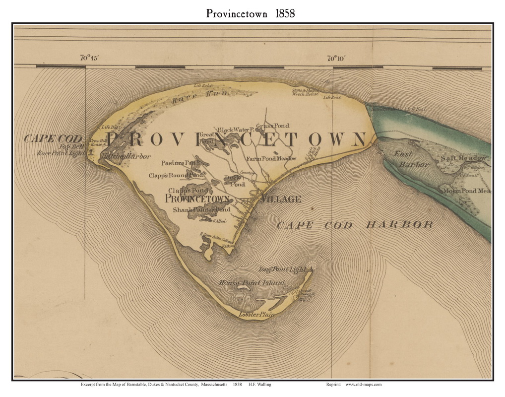
Masschusetts:
State Maps
Counties:
Barnstable, Dukes & Nantucket
Berkshire
Bristol
Essex
Franklin

Hampden
Hampshire
Middlesex
Norfolk
Suffolk
Plymouth
Worcester


Old  Maps  of Provincetown
Attractive maps for wall display - Reprints

Click on a thumbnail to see a low-res view of the map (images are degraded for the web).

Click here to view our collection of Provincetown maps at shop.old-maps.com
        1836 Provincetown                                                                           1836 Provincetown & Truro
See separate page

Made by the US Bureau of Topographical Engineers
   
1858  Provincetown - Walling

From the large county wall map
1858  Provincetown Village

From the large county wall map
 
1841 Cape Cod Harbor

National Archives  

Old Provincetown USGS Topo Maps
A series of old topos starting in 1890
See Separate Page 

1858   Provincetown Poster Map

Click here to purchase this and other Barnstable Co. Poster Maps


Revised: 
Copyright © 2005 [Old Maps]. All rights reserved.