|


Masschusetts:
State Maps
Counties:
Barnstable, Dukes & Nantucket
Berkshire
Bristol
Essex
Franklin
Hampden
Hampshire
Middlesex
Norfolk
Suffolk
Plymouth
Worcester
|
|
|
|
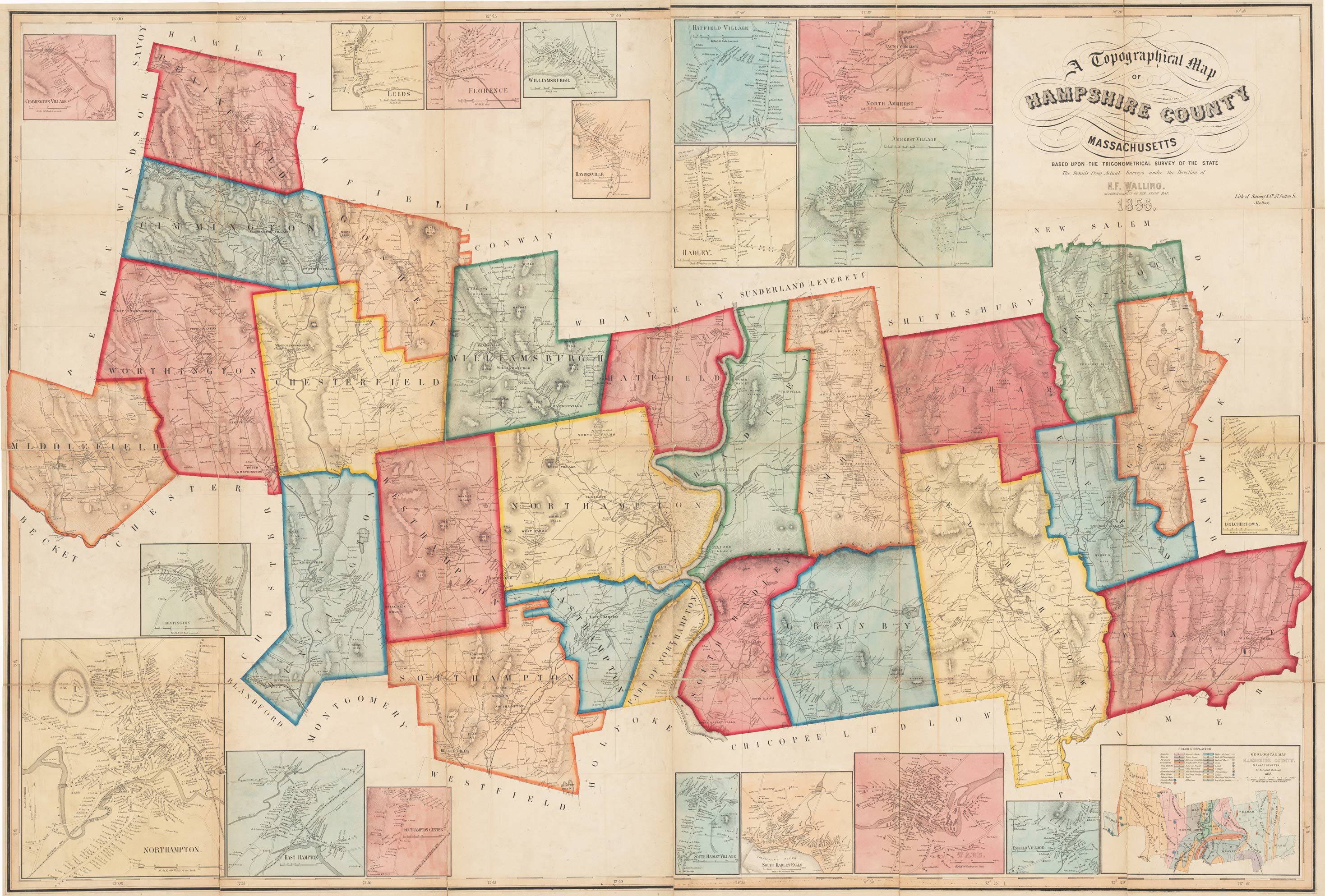
Hampshire County
1856 Map
Wall Map Reprint
Suitable for hanging on your
wall
HampshireCo
Town Prints
1860 County Map |
The Map of Hampshire County, 1856, is now available as a paper reprint.
This remarkable map shows all the roads in Hampshire County and identifies each house and business by the
owner's name.
This was the first of H. F. Walling's two maps of Hampshire County.
In 1860 he produced another one, which is available on a
CDROM. |
|
Click here
to purchase this map through our store at shop.old-maps.com |

Click on the Image above for a more detailed view. Original size: 41" x
60" |
The
reprint is made from the original at the Harvard Map Collection. We have
edited the original to improve its appearance. All data shown on the original map is now available
We offer this map at several different sizes.
Some text will be
hard to read or illegible at the smaller sizes, but the map still makes an
attractive wall display.
|
|
|
|
|
|