|
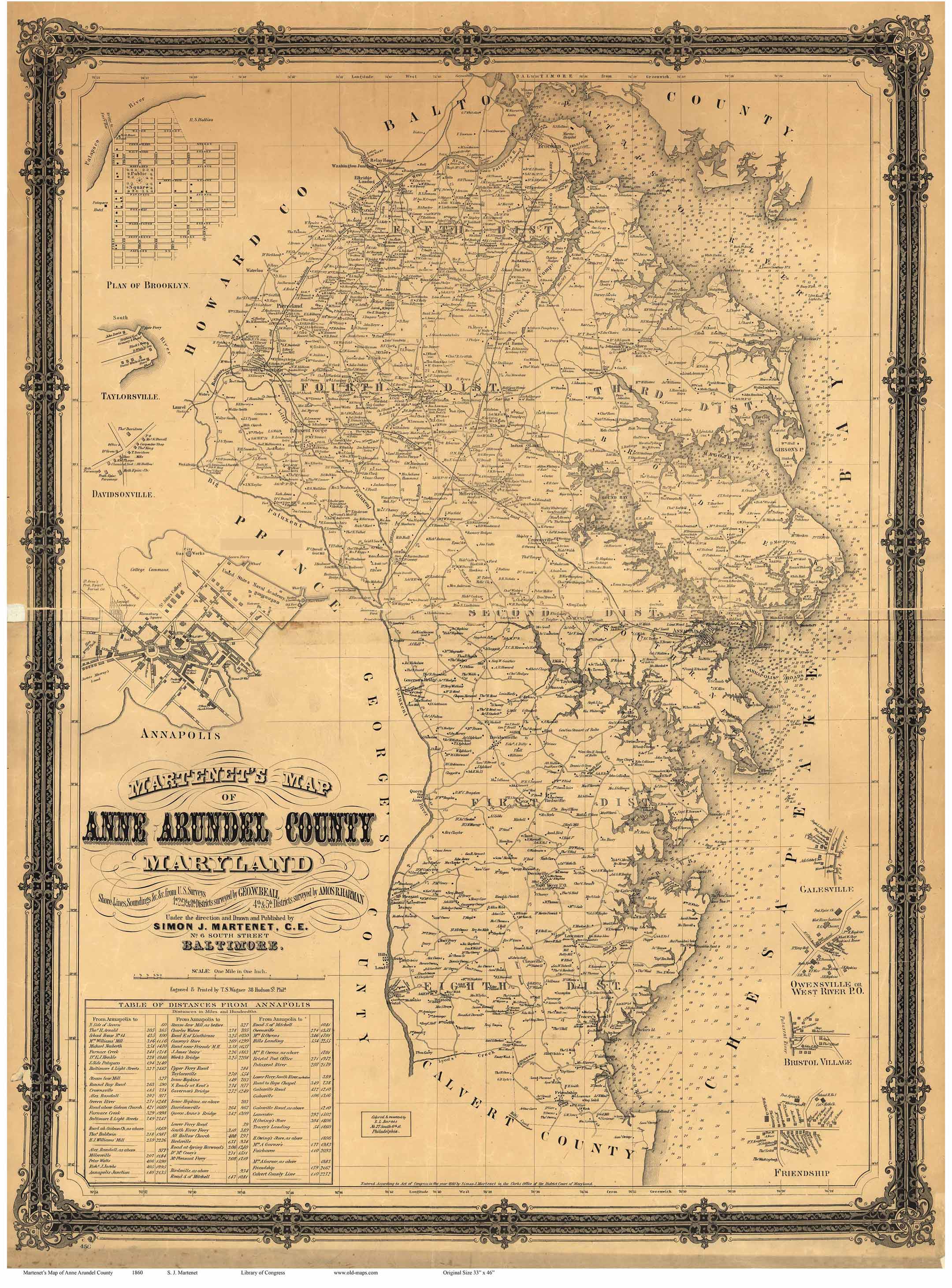
Old Map of Anne
Arundel County 1860
Maryland
WALL MAP REPRINT
Home
Town Maps
CDROM |
|
Click
here to purchase this map through our store at shop.old-maps.com |

Click the above image to see it enlarged.
Orig size: 34" x 46"
(Original from Library of
Congress, Geography and Map Division) We have added colors to the
original LC image to make it more attractive.
Click here to see
the unedited original.
|

|
The 1860
"Map of Anne Arundel County, Maryland" is available as a reproduction print in
multiple sizes.
The two smaller versions are
reduced from the original size, all text still is
visible the smallest size offered.
Printed on heavy white bond paper,
suitable for framing.
Shipped rolled in a
tube. |
| Towns on the map: |
1st District -
Davidsonville
2nd District - Annapolis
3rd District -
Pasadena
|
4th
District - Millersville
5th District - BWI Airport
8th
Distict - Bristol
|
|
|
|
|

