Historical Nautical Charts of the Chesapeake Bay
1:80,000 Scale Chart 32
Rappahannock Entrance Mobjack Bay
Cherrystone Inlet
Maryland Main Page
Chesapeake Bay 1:80000 Nautical Charts
Maryland Nautical Charts
View these maps on our new site!
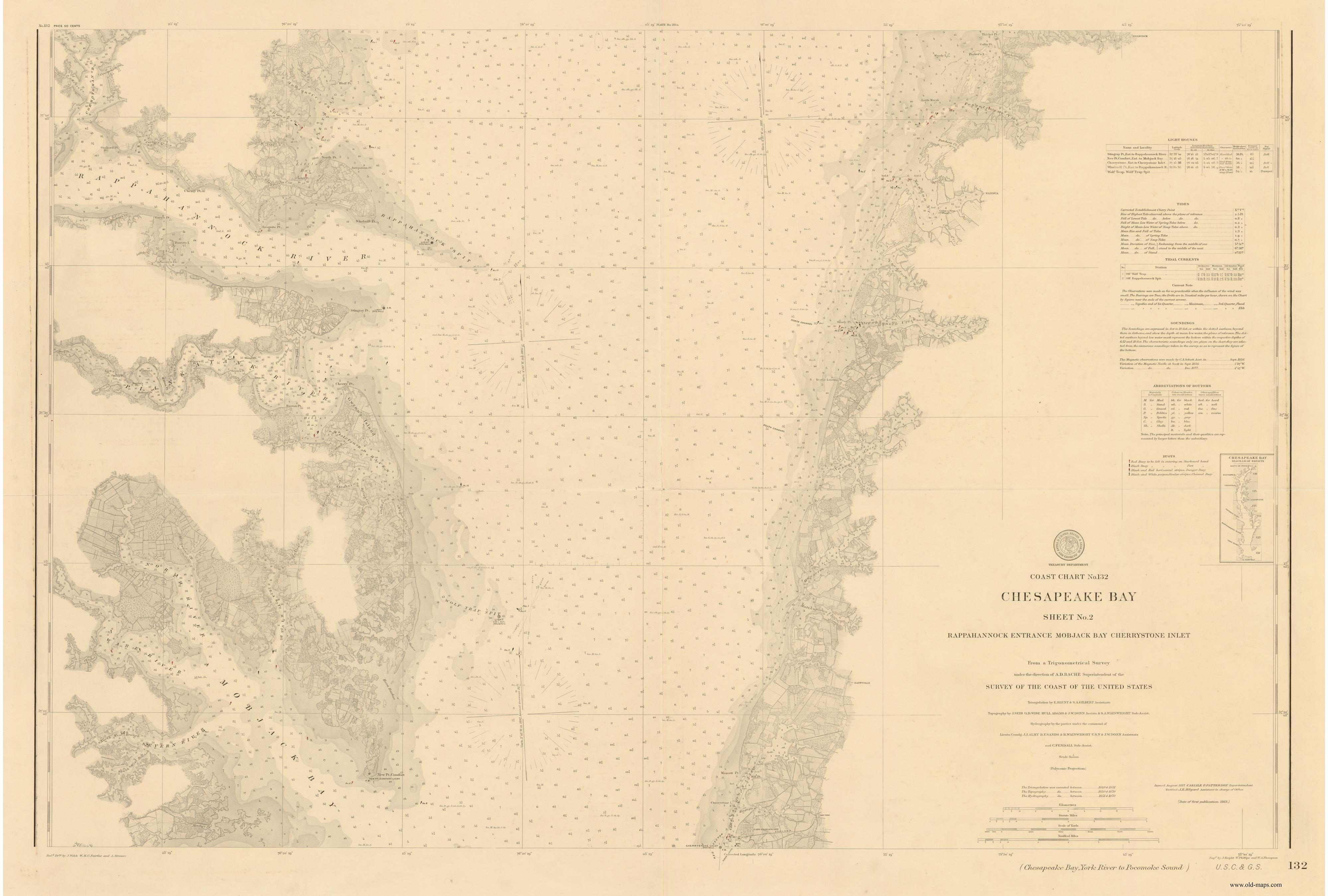
Chesapeake Bay Chart 32 - Rappahannock Entrance
Mobjack Bay Cherrystone Inlet 1863
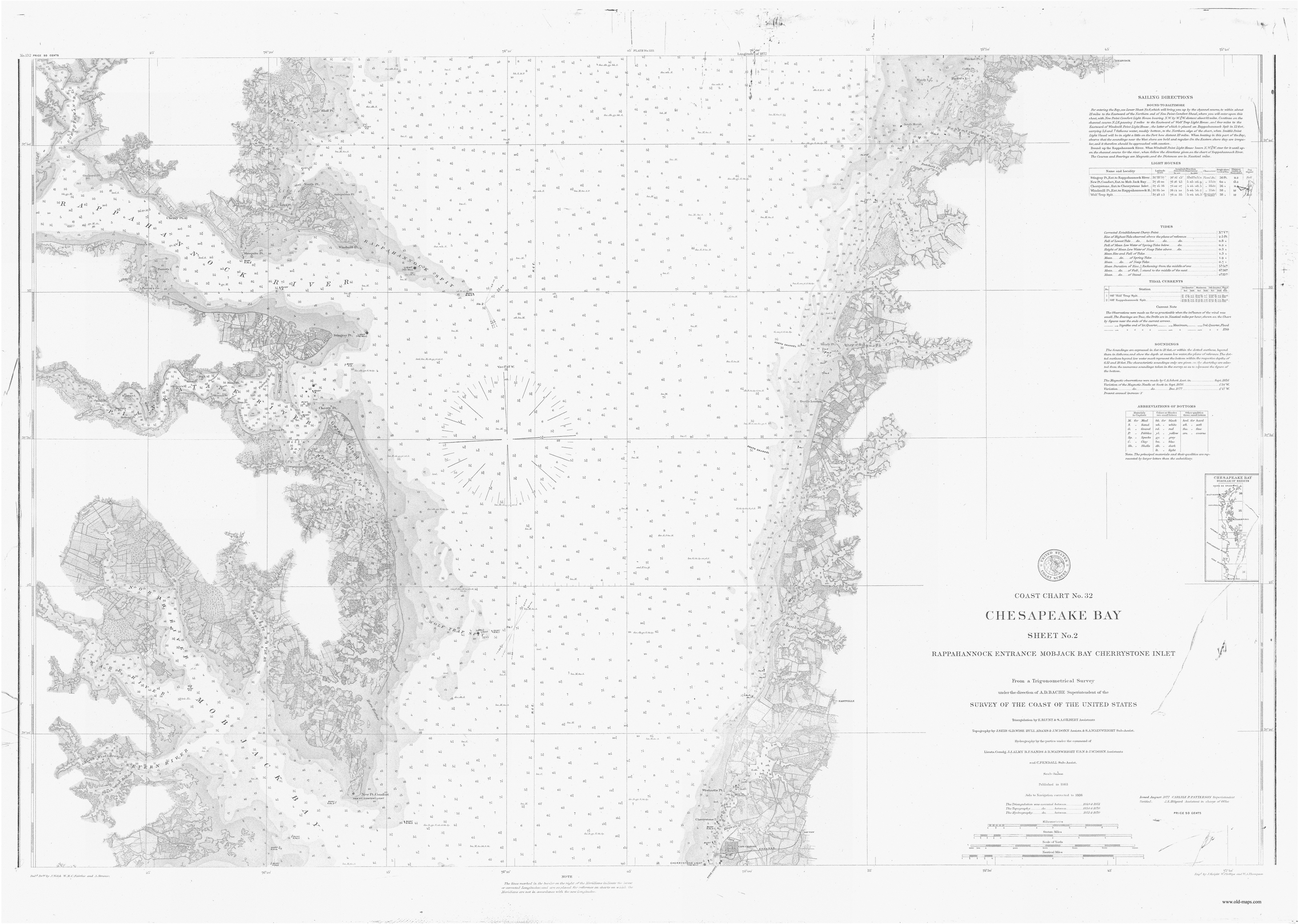
Chesapeake Bay Chart 32 - Rappahannock Entrance
Mobjack Bay Cherrystone Inlet 1872
Chesapeake Bay Chart 32 - Rappahannock Entrance
Mobjack Bay Cherrystone Inlet 1877
Chesapeake Bay Chart 32 - Rappahannock Entrance
Mobjack Bay Cherrystone Inlet 1886
Revised: 07/12/22
Copyright © 2005 [Old Maps]. All rights reserved.