Old-Maps


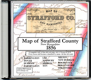
Strafford County Maps
Most of our maps are on CDROM collections.
Individual town maps can also purchased separately as Custom Prints.

Town / County Maps

1856 County Wall Map
Old Maps of Strafford Co NH, 1856 Old Maps of Strafford Co NH, 1856 Old Maps of Strafford Co NH, 1856
Wall Map CDROM Town Maps
1816 Carrigain County Print Old Maps of Strafford Co NH, 1871 AtlasOld Maps of Strafford Co NH, 1871 Atlas
1816 Strafford County Map
from the Carrigain State Map
1871 Atlas of Strafford County
CDROM and Town Prints


Outline Map of Strafford Co, NH
Strafford County Towns:
Barrington
Dover
Durham
Farmington
Lee
Madbury
Middleton
Milton
New Durham
Rochester
Rollinsford
Strafford
Somersworth
 

Early State Maps

These New Hampshire State maps provide additional town and county detail.

1) 1761 Blanchard & Langdon
2) 1784 Holland Map
3) 1816 Carrigain map


Vermont
New Hampshire
Massachusetts
Maine
Connecticut
Rhode Island
New England

New York
New Jersey
Pennsylvania
Delaware
Maryland
Washington DC
Virginia


Background
News Coverage
Contact Us
Order Form
FAQ


Revised: 10/15/20
Copyright © 2009 [Old Maps]. All rights reserved.