Original Size 49" x 64" |
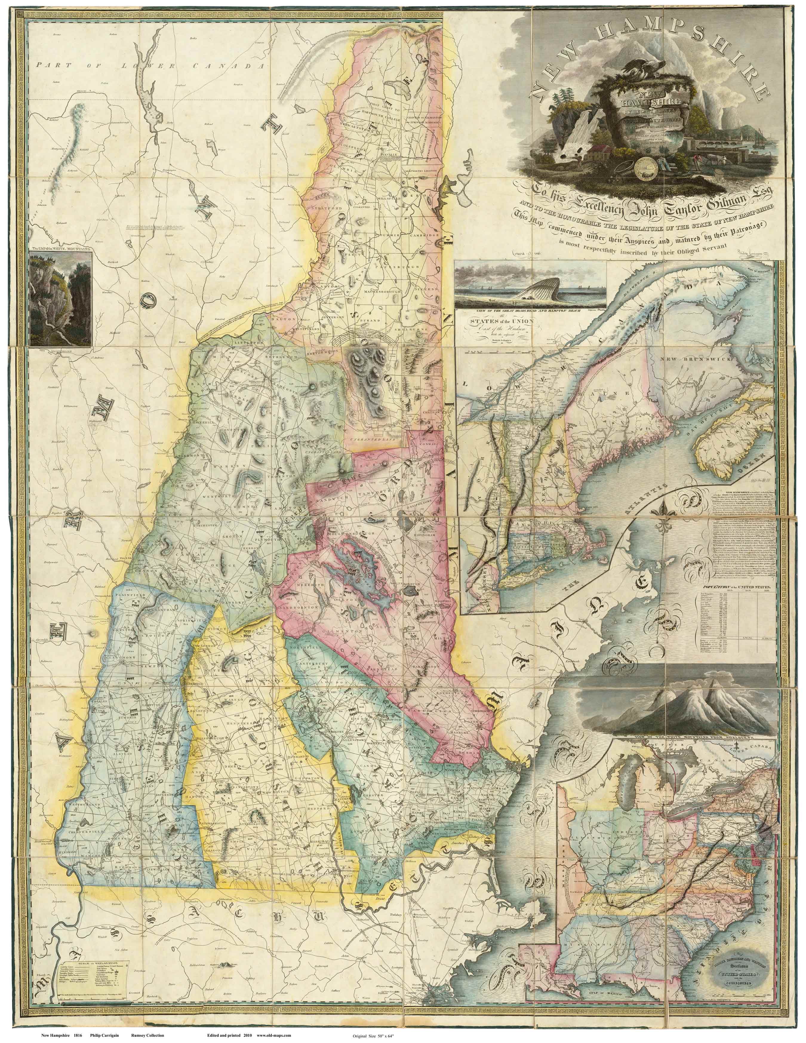
The most comprehensive map of New Hampshire for the early 1800s was Phillip
Carrigain's "Map of the State of New Hampshire". This oversized map
shows remarkable detail throughout the state, including major roads and
building sites.
To see a detail from
the paper edition click hereAvailable in three reproduction formats:
1) Wall Map Reprint, A full color print on heavy bond
paper. Several sizes available through our new store.
2) Paper Sheets Edition on 18 separate
map sheets
(click here for details)
3) CDROM Edition
The CDROM Edition consists of the entire map in 3 JPEG files
at 300 dpi. (top, middle and bottom of NH). Also, the entire map is
issued as a single image at 150 dpi.
No software is supplied. |