Vermont:
State Maps
Counties:
Addison
Bennington
Caledonia
Chittenden
Franklin & Grand Isle
Orleans
Lamoille
Essex
Orange
Rutland
Washington
Windham
Windsor
Town/County Index
Bookstores
Press Releases
Articles/Research |
|
|
|
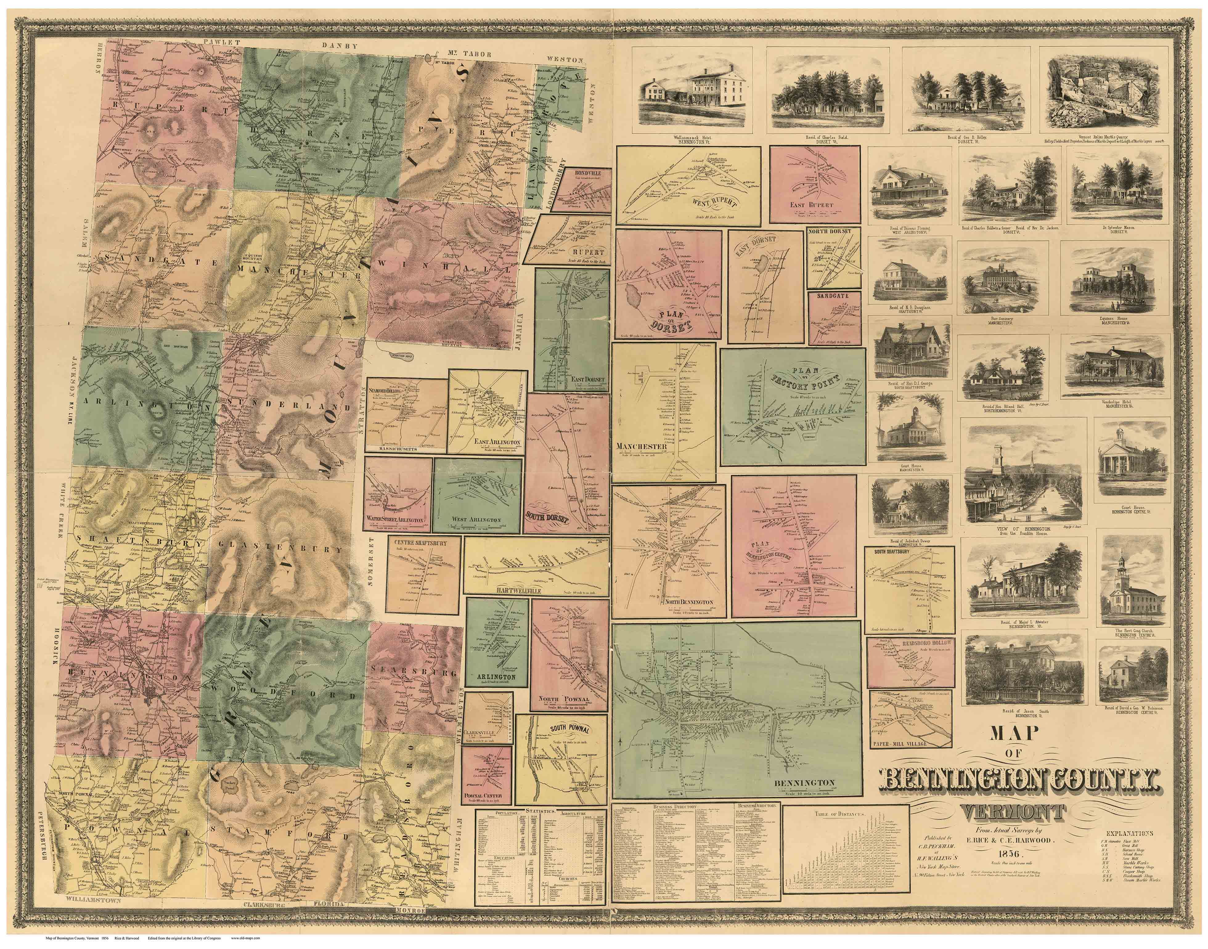
1856 Bennington County
Wall Map Reprint
BenningtonCo
CDROM
Town Prints |
The 1856 "Map of
Bennington County" is a oldest complete road
map of these towns. It shows all the houses and roads in
Bennington County in 1856. Original copies are rarely found today, and
are often in poor condition.
Full color reproductions of this beautiful map are now available.
Original
size: 44" x 56"
Click here
to purchase this map through our store at shop.old-maps.com |
|

Click on the image above for a more detailed view.
You
will not be able to read all the names, but you can get a better sense
of the charm and detail of the printed map. |
|
=================================================================================
To order by mail, send a check for $50 to Old Maps PO Box 54 West
Chesterfield, NH 03466 |
|
|
|