Vermont:
State Maps
Counties:
Addison
Bennington
Caledonia
Chittenden
Franklin & Grand Isle
Orleans
Lamoille
Essex
Orange
Rutland
Washington
Windham
Windsor
Town/County Index
Bookstores
Press Releases
Articles/Research |
|
|
VT
State Maps
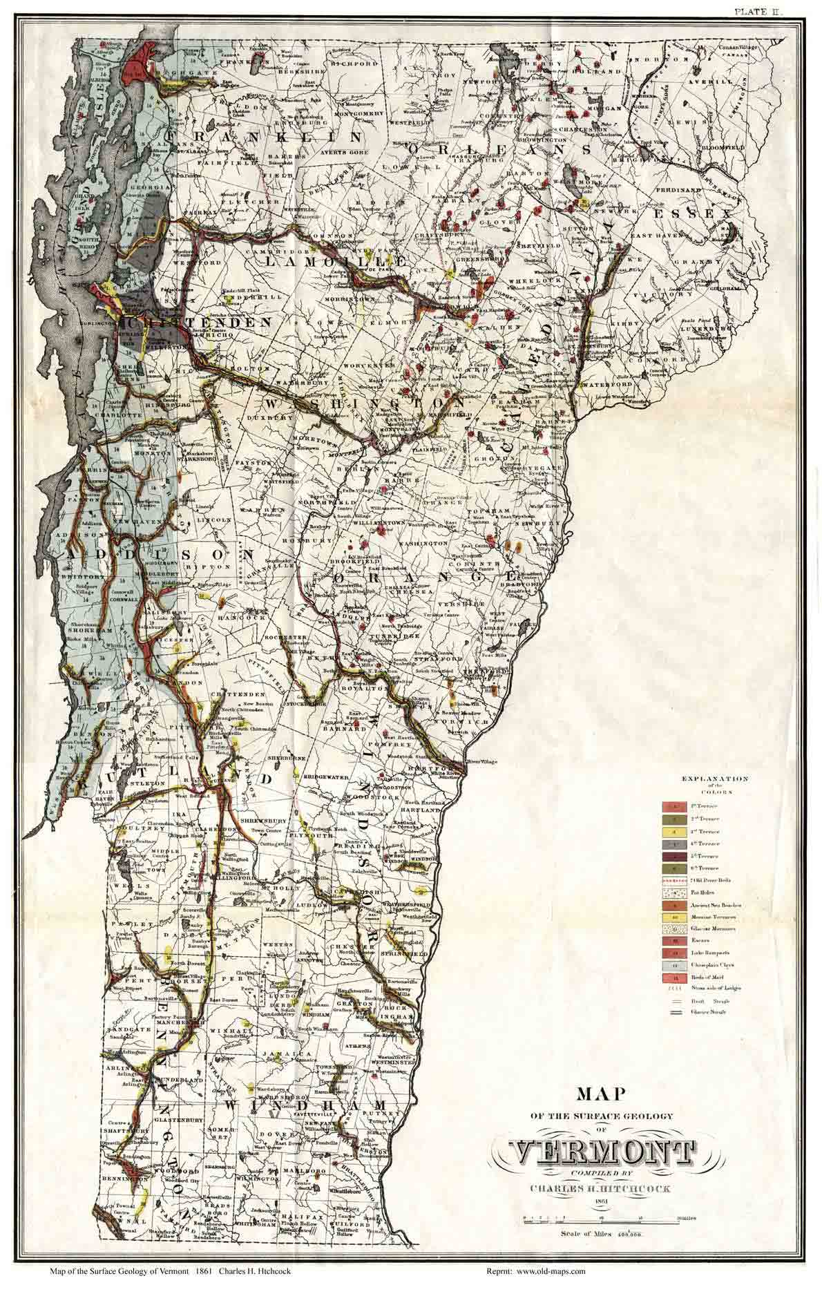
Geological Map of
Vermont 1861
By Charles Hitchcock, noted American Geologist. |
| Home
State Maps |
Click here to purchase this VT State Map |
 |

This was the first Geological map made of the state of Vermont. It
was put together using information from the the first Geolocial
Survey of Vermont, which had been conducted for several years prior
to 1861. Charles H. Hitchcock was at that time the assistant to the
Vermont State Geologist; his father Edward Hitchcock.
The map
shows the details of Vermont’s rocks, soils, metals, and minerals.
Charles Hitchcock later served as State Geologist for Maine and then
New Hampshire, and was one of the founders of the Geological Society
of America. |
|
|
Click on the map above to see a more detailed copy.
Original size: 13" x 19" |
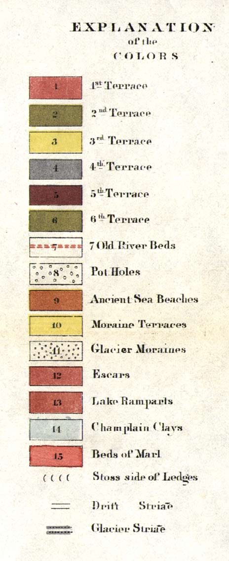
The images below show
the level of detail on this map |
|
|
|
 |
 |
 |
| |
|
|
Revised:
08/21/17
Copyright © 2005 [Old Maps]. All rights reserved.
|