|
The best way to get started on Ancient Roads research is to
make a Compilation Base Map showing old
roads from the 3 older maps (1850s, 1870s and old USGS). We suggest that this Base Map be drawn by hand on
one of the 2 copies of the 2003 State Highway Map we provide.
Making this map is only a first step - but it is an easy way to get started
on Ancient Roads research. If you would like us to make this map for you,
click here. |
|
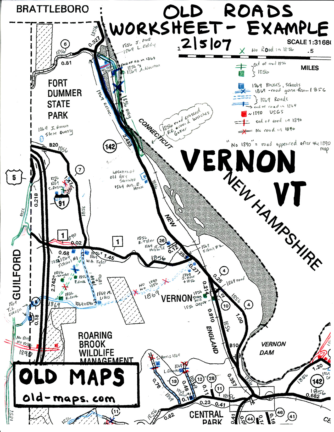
Enlargement from Sample
Base Map.
The heavy dark line are roads shown on the 2003 State Highway Map.
This area of Vernon had 3 old roads per the 19th century maps. In this
example the maps are 1856, 1869 and 1890. It is useful to show the
homeowners from the old maps because the names help you connect the maps,
and they suggest a public road leading to the house. |
Sample base map for
download.
Click Here to
download this sample base map. It is an 8" x 11" portion of the
compilation we did for the Town of Vernon, Vermont. (It is an 800k file.)
This is about one quarter of the entire base map, which was prerpared at a
scale of 1" = 2000' (scale of the modern USGS topo map). |
|
The Next Phase - Modifying the Base
Map with new Information
Once you have made your Base Map, you will note discrepancies
with things you see on the ground, such as road intersections as you drive
down the road. This is because the older maps were not based on highly
accurate surveys. You can correct the map with what you see on the
ground.
And, most importantly, you will find information about possible old roads
which existed before the 19th century maps. Many Vermont roads were
created in the decades from 1770-1830, before these old maps were made. The
documentation for these roads resides mostly in Town Meeting minutes.
Physical evidence of these old roads exists in the woods today. You can map
these old woods roads roughly using the modern topographic maps to draw
their approximate routes or use technology such as GPS to map them
accurately. |