Vermont:
State Maps
Counties:
Addison
Bennington
Caledonia
Chittenden
Franklin & Grand Isle
Orleans
Lamoille
Essex
Orange
Rutland
Washington
Windham
Windsor
Town/County Index
Bookstores
Press Releases
Articles/Research |
|
|
|
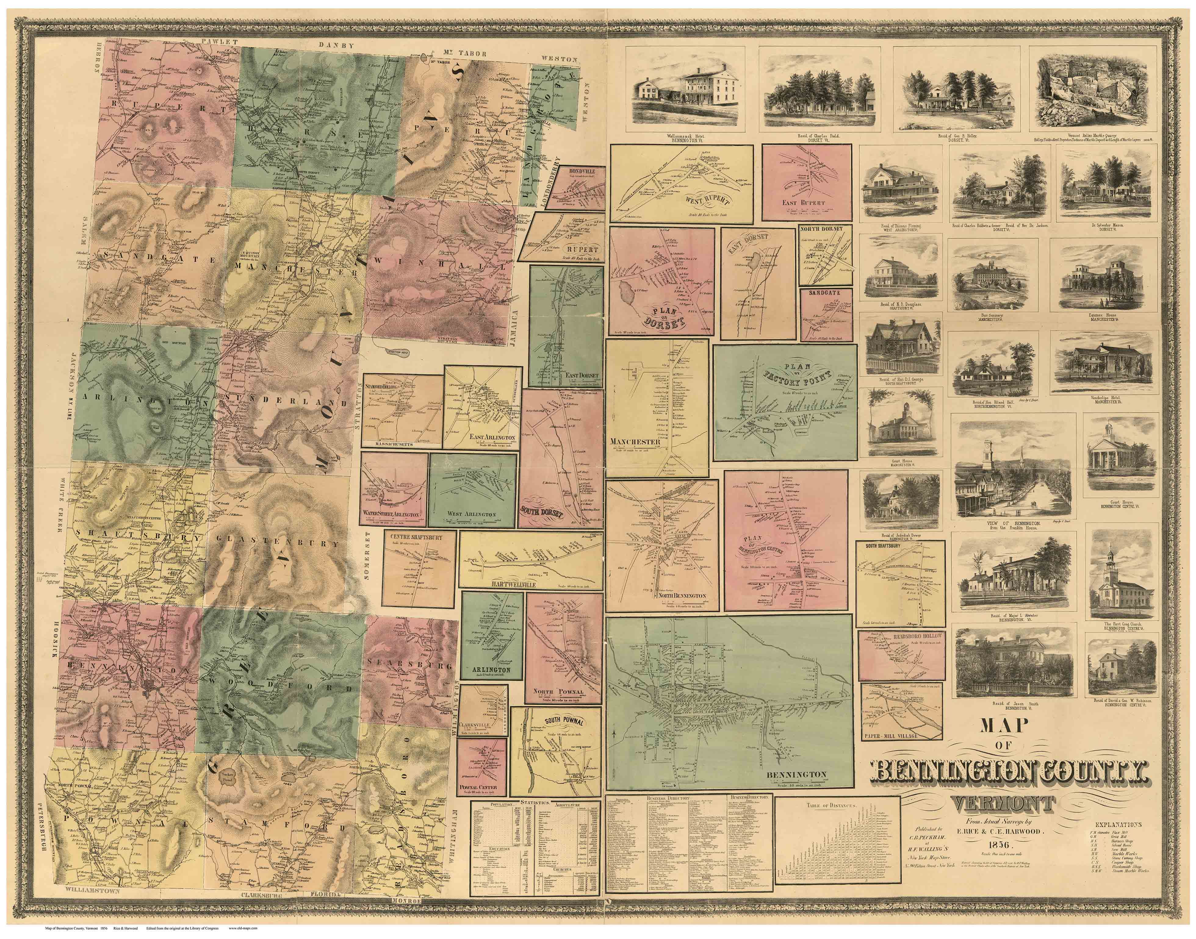
Map of
Bennington County, Vermont
1856
The first detailed road map of
the county
Every road and every house - with the owner's name
BenningtonCo
Wall Map
Town Prints |
|
|
|

The full 1856 map
Contents of CDROM |

The 1856 Map of Bennington County, Vermont
by H.F. Walling, shows every road in the 17 towns of Bennington
County. 1000s of sites - homes, schools, churches and businesses- are
located and named. |
ARLINGTON
BENNINGTON
DORSET
GLASTENBURY
LANDGROVE
MANCHESTER |
PERU
POWNAL
READSBORO
RUPERT
SANDGATE
SEARSBURG |
SHAFTSBURY
STAMFORD
SUNDERLAND
WINHALL
WOODFORD |
|
 |
|
- CDROM FORMAT
- 46 town and
village maps
- 21 pictures of buildings and scenes
- Business Directory of 200+
names
-
formatted to 56 - 8 1/2" x 11" pages
-
CD-ROM,
Adobe PDF Format
|
|
Click here to purchase this CD-ROM on our new website. |
| |
|
|
|
|