RI:
State Maps
Birds Eye Views
Counties:
Newport
Providence
|
|
|
|
Old Topographic Map
Narragansett
Bay, RI
RI USGS Quads
Narragensett
Bay Maps |
|
Click here
to purchase this map through our store at shop.old-maps.com |
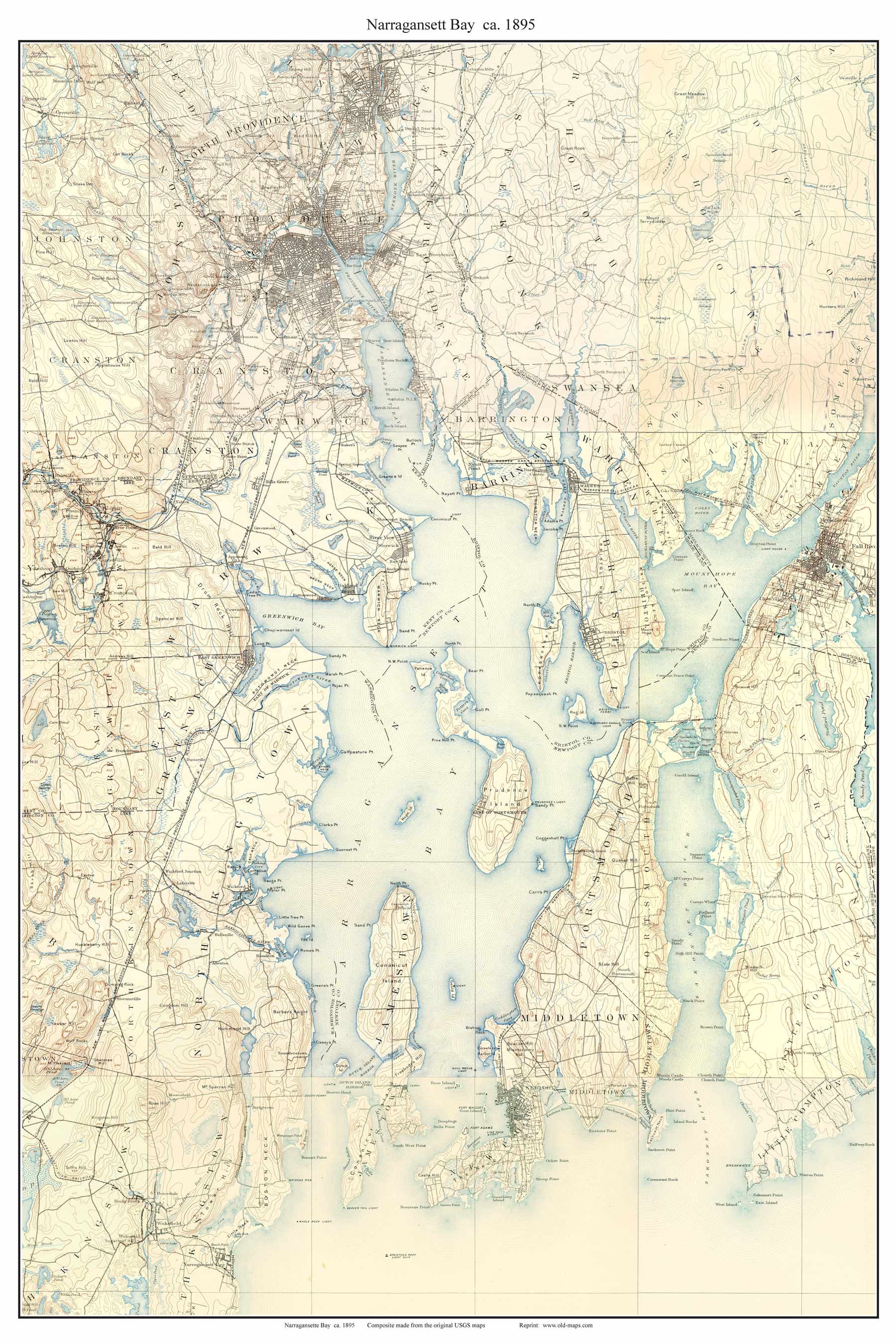
A composite map made from 9 old USGS
Topographic Maps
Click on the map right
to see a low resolution image.
Old
topographic maps, which have much less detail than
modern "USGS" maps, make for very pleasant wall
decorations.
 |
 |
|
Available in multiple sizes
The old topo maps show every road and all principal
buildings, as well as lakes, rivers, railroads and
elevations. These maps were made before the
Cape Cod Canal, as seen in the excerpt below. |
 |
|
This wall map reprint are made
from 9 original old USGS topographical maps. We
have stitched them together and added a border to
make this a pleasing wall decoration.
Separate Prints of the old USGS Maps are
available here
|
|
Questions? Contact
us by email |
|
|
|