RI:
State Maps
Birds Eye Views
Counties:
Newport
Providence
|
|
|
|
Nautical Charts
of Rhode Island
Nautical Charts of
Narrgansett Bay
Home
Nautical Charts
 |
|
All of our Rhode Island Nautical Charts are available
for viewing and purchase through our new store at
shop.old-maps.com!
|
|

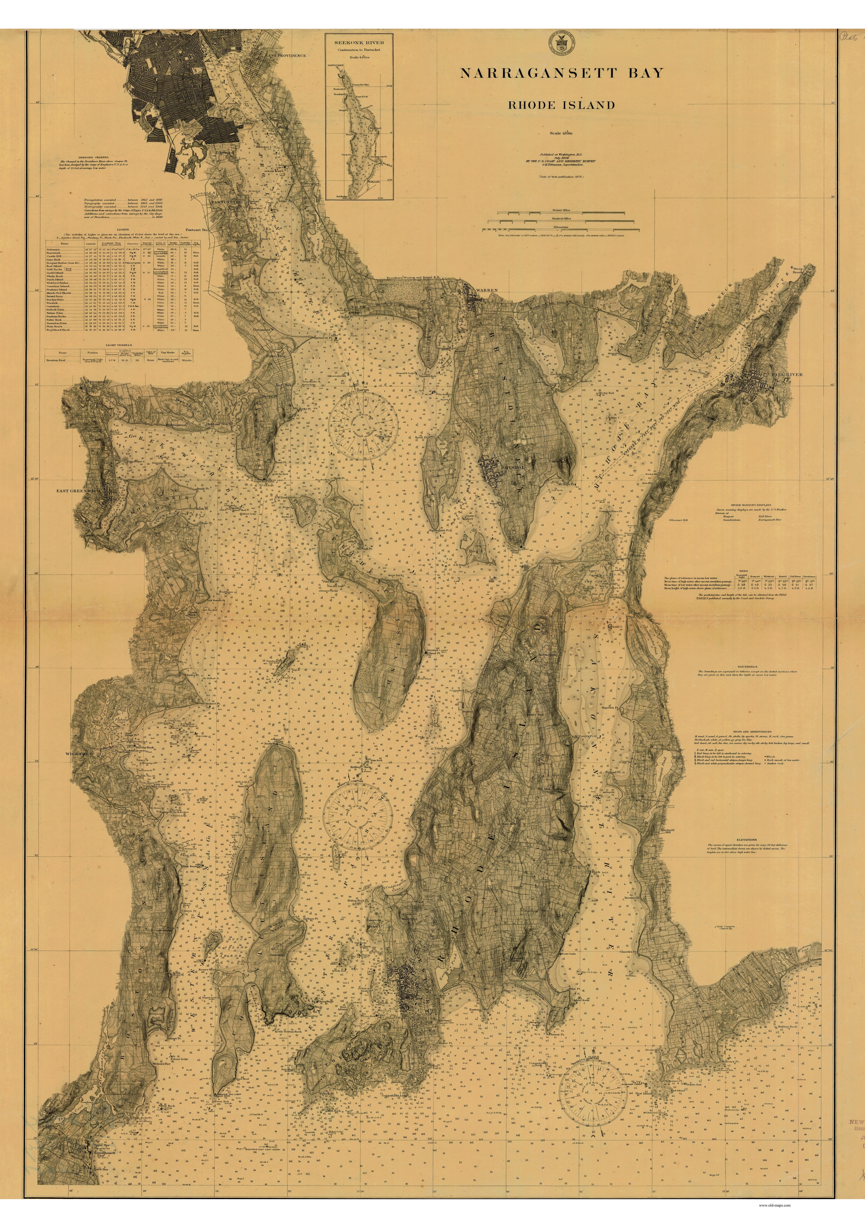
**This map is missing 3" along the top**
Shows property lines & field boundaries
|

|
1906 - Original size 32" x 45"
|
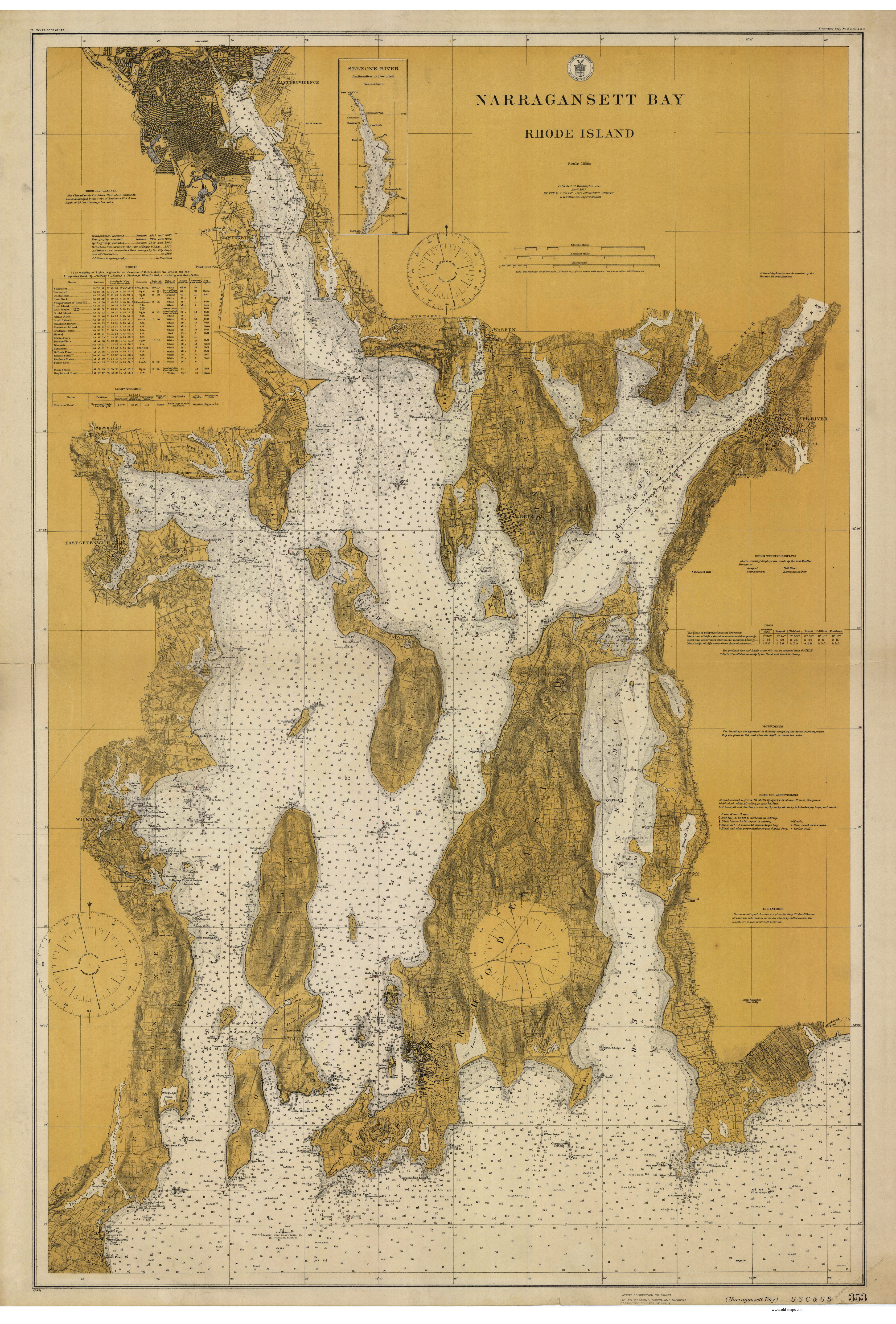
1915 - Original size 33" x 48" |
|
|
|
 |

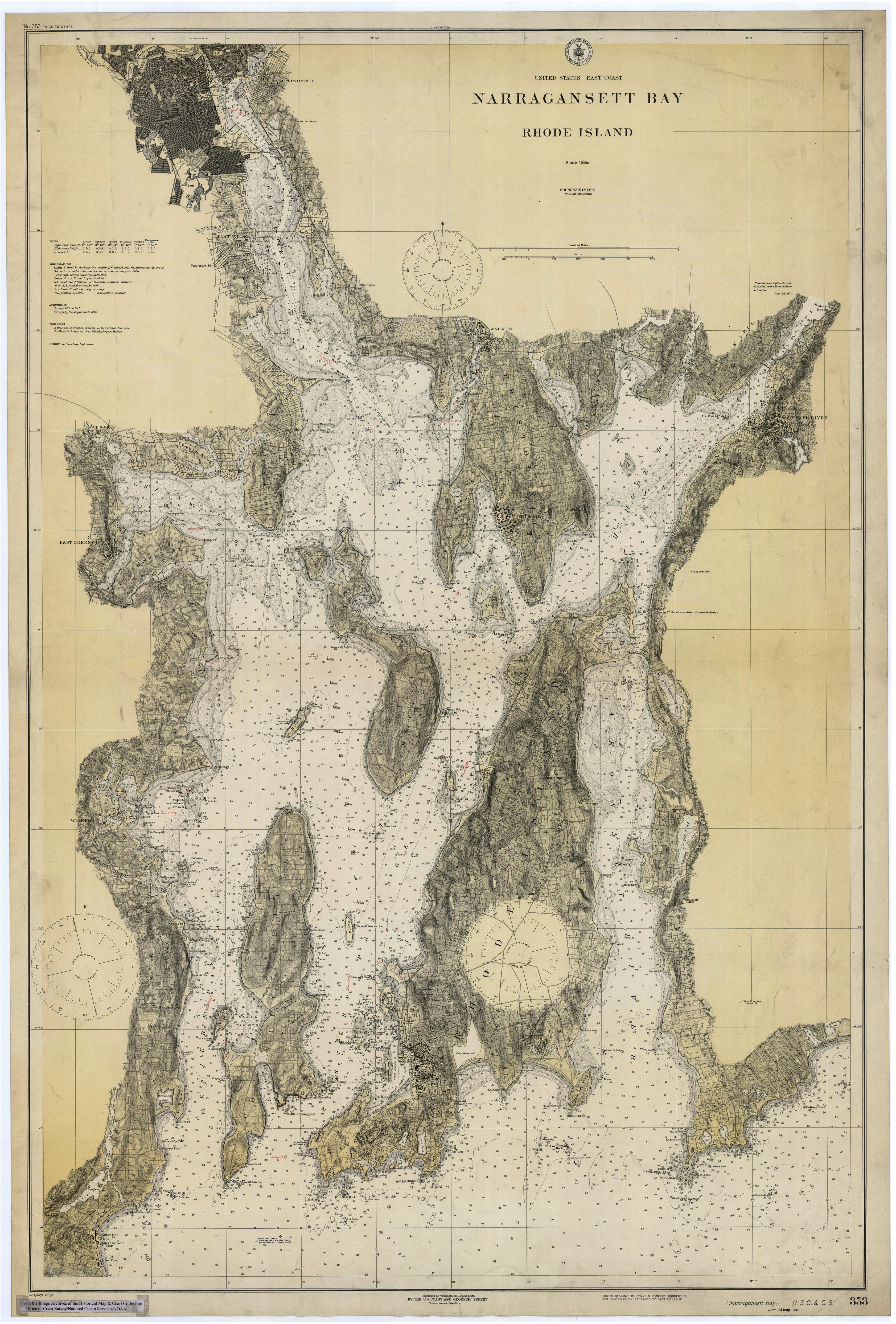
Shows Contours |
1921 - Original size 33 x 49"
|
1930 - Original size 32" x 48"
|
|
|
|
|
|