RI State


Old-Maps

Vermont
Massachusetts
New Hampshire
Maine
Connecticut
New York
Rhode Island
New England
Background
News Coverage
Contact Us
Order Form
FAQ

RI:
State Maps
Birds Eye Views

Counties:
Newport
Providence


Old Maps of Rhode Island
Old  Maps  of  Newport
Attractive maps for wall display - Reprints
RI Home                  Narragansett Bay

Click here to purchase a map through our new store at shop.old-maps.com!  Prints offered in multiple sizes.
Map of Newport RI, 1777 Blaskowitz
1777  Blaskowitz
orig. 13 x 14
Map of the Narragansett Bay RI, 1777
1777  Schiffer
orig. 14" x 20"
Newport RI Battle Map, 1778
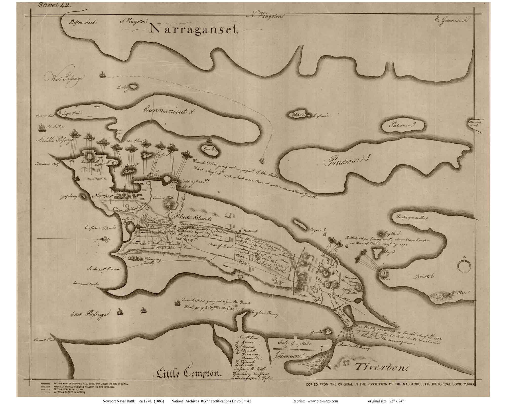
1778  Newport Battle
orig. 22 x 24
 Shows positions of various fleets during an important naval battle.
Reference quality scan edited to remove minor flaws
Manuscript from National Archives
Newport RI Battle Map, 1778
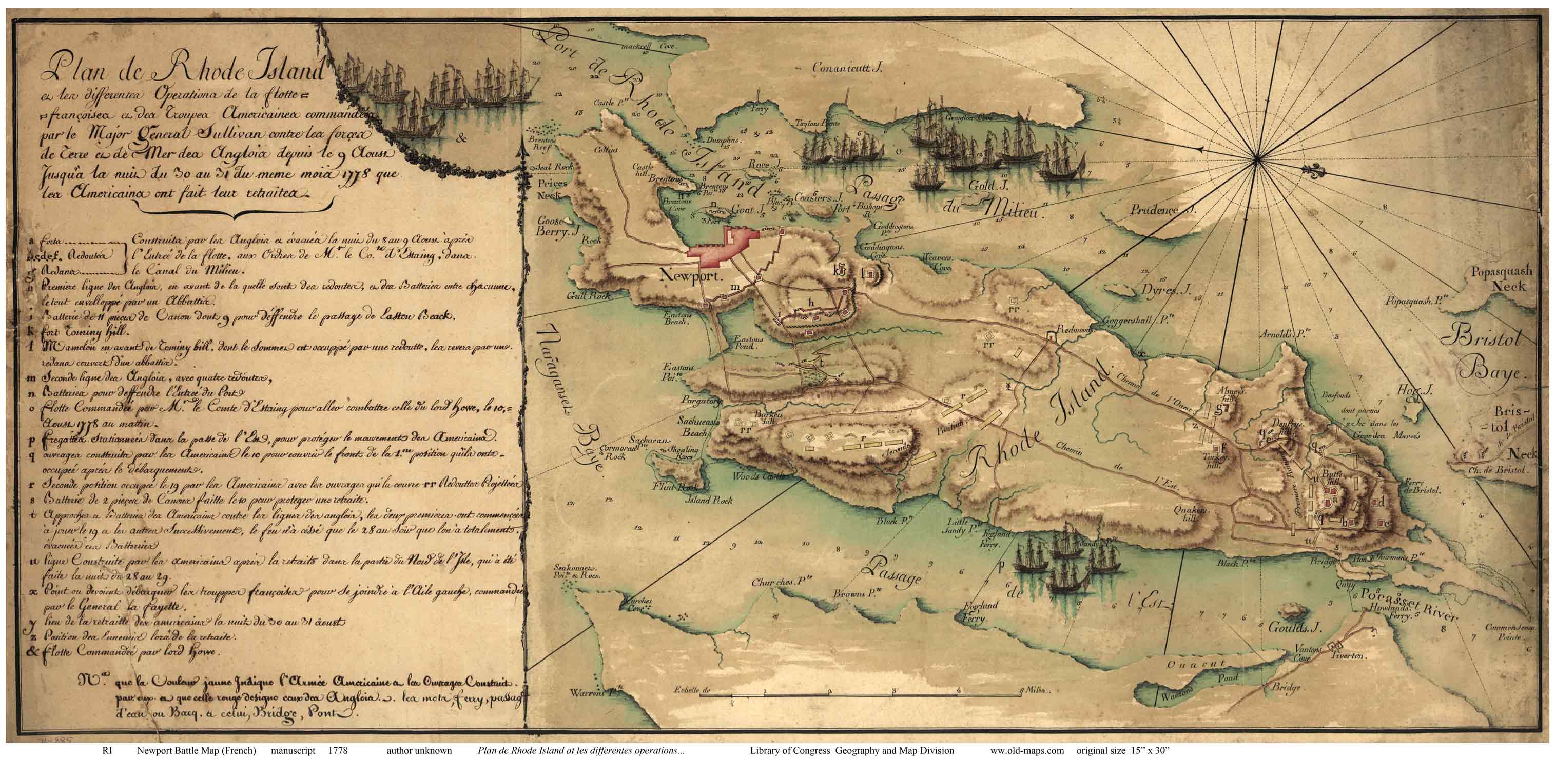
Custom print excerpted from the larger map from the Library of Congress. (See right)
Newport RI Battle Map, 1778 (French)
1778  Newport Battle Map (French)
orig. 15 x 30
 Reprint of the manuscript from the Library of Congress. Author unknown, but appears based on the "Capitaine" map which shows the identical area with different graphics.  See also the excerpt with the map only.
Newport RI Battle Map, 1778
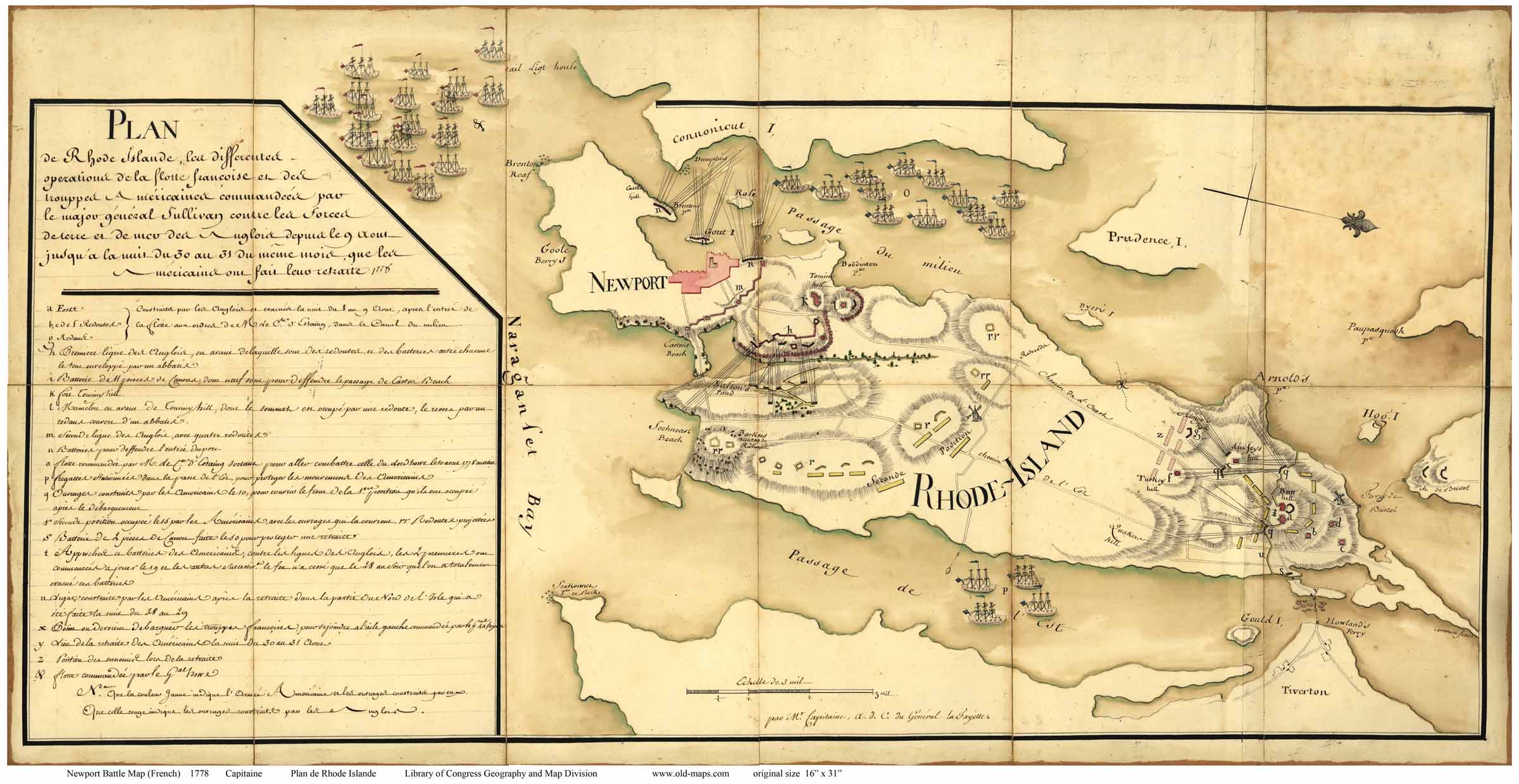
1778  Newport Battle Map - Capitaine
orig. 16 x 30
 Reprint from the Library of Congress. Same map area as the "Battle Map (French)", but less polished than the latter.  Author is "M. Capitaine".
Newport RI French Military Map, 1780
1780 French Military Map
orig. 47 x 60
Edited from the original at the Library of Congress
Map of Newport RI, 1780 Rochambeau
1780  Rochambeau
orig. 24 x 25
Library of Congress - Geography & Map Division
Map of Newport RI, 1780 Rochambeau 
1849 Hammet
orig. 11 x 17
Map of Newport RI, ca. 1860
ca1860  Newport Town
orig. 25 x 34
Map of Newport RI & Vicinity, 1870
1870  Newport & Vicinity
orig. 18 x 24
Map of Newport City, 1870
1870  Newport City
Custom Print


Revised: 06/15/17
Copyright © 2005 [Old Maps]. All rights reserved.